iTASK Offer web development, GIS & Remote Sensing and ecommerce software development services Located in Chennai and Hyderabad India.
iTASK specializes in GIS, Web GIS,Digital Imapge proecessing, Opensource GIS Application Development, PHP,JAVA,ASP,ASP.NET. ASP.NET2, .Net Visual Studio.Net 2.0, J2EE, AJAX, My SQL ,OLAP and has designed and developed many major projects using all.
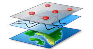
GIS
1.Introduction to GIS Mapping
2.Spatial Analysis
3.Vector Data
4.Raster Data
5.Editing
6.Geoprocessing
Web GIS
1.Introduction to Web Mapping
2.Web GIS
3.HTML, CSS
4.Java Script,
5.Publishing Vector and Raster Data
6.Editing
7.Deploying Web App
Remote Sensing
1.Introduction to Remote Sensing
2.Image Statistics
3.Basics of RS
4.Image Processing
5.Change Detection
6.Image Acquisition, Analysis and Applications
7.Satellite Imagery Analysis in Python
Digital Image Processing
1.Introduction to DIP
2.LULC
3.Data Processing and Analysis
4.Image Processing Algorithms
5.Programming for Geodata Processing
6.Spatial Modelling and Data Assimilation
7.Satellite Imagery Analysis in Python

1. About GeoServer
2. Installation GeoServer on Windows Environment
3. Introduction to GeoServer Web Interface
• Overview of GeoServer User Interface
• Menus
• GeoServer Architecture & Protocols
4. Working with Vector Spatial Data
• About Workspaces
• Create Workspace
• About Stores
• Import Vector Data to Store
• Publish Vector Data to GeoServer
• Web Map Service (WMS)
• Serving Cascading WMS
• Web Feature Service (WFS)
• Differences WMS and WFS
• Layer Preview in GeoServer
• Connect and Work with QGIS (Part-1)
• Connect and Work with QGIS (Part-2)
• Create Layer Group
5. Working with Raster Data
• Importing Raster Data
• Raster Data and WCS
• Visualize Raster in QGIS using WMS and WCS
6. Layer Styling
• Basic Concepts
• Styling Point Features
• Styling Line Features
• Styling Polygon Features
• GeoServer Basic Vector Styling
• Exporting SLD from QGIS
• Styling Raster Data
• GeoServer Basic Raster Styling
GIS Data Acquisition and Map Design
1.Introduction to GIS and Data Acquisition
2.Thematic Maps
3.GIS Data Processing and Analysis
4.Data Editing
5.Programming for Geodata Processing
6.Spatial Modelling and Data Assimilation
7.Analysis in Python


